Adela and Shawn began working in Bulgaria in 2004, on a project investigating enigmatic Late Bronze Age and Early Iron Age structures under mounds (perhaps depots or watchtowers), directed by Prof. Mark Stefanovich, American University in Bulgaria (AUBG), Blagoevgrad. In 2006, Shawn spent a semester at AUBG on a Fulbright Award. The experience was valuable but the project wound down soon after.
At about that time, we made contact with the nascent American Research Center in Sofia (ARCS). They in turn facilitated collaboration with Sofia University and the Yambol Museum during 2007-2008, culminating with a preliminary archaeological surface survey of 2.8 sq km around the ancient city of Kabyle (directed by Dr. Ilija Iliev and funded by a grant from the Faculty of Arts and Social Sciences at UNSW). This pilot project demonstrated the potential of archaeological surface survey in the middle Tundzha Valley.
In 2008, Dr. Simon Connor (then at the University of the Algarve, Portugal) also initiated the palaeo-environmental component of our research, collecting samples for palynological analysis from suitable areas near Yambol.
An article based on the 2008 surface survey and palynology is currently under review by Archaeologia Bulgarica.
Meanwhile, during 2007-2008 we were involved with a satellite remote sensing project in Apulia, Italy, directed by Dr. Gert-Jan Burgers of the Free University of Amsterdam and the Royal Netherlands Institute in Rome. This project evaluated 100 sq km of high-resolution multispectral QuickBird satellite imagery for features associated with archaeological remains. Results were then compared with data from the pre-existing surface survey directed by Dr. Burgers. This project produced an article that has been accepted for publication by the Journal of Field Archaeology (forthcoming 2009). Methods developed in Italy are being applied in Bulgaria.
The results of our research to date formed the basis of a successful Australian Research Council (ARC) Linkage Project application in 2008. Linkage awards are matching grants given to researchers who have secured support from non-university partners. This award, combined with several smaller grants, will provide secure funding for our project from fall 2009 through 2011.
An ARCS Fellowship and a Rackham International Research Award allowed Adela to spend the 2008-2009 academic year in Bulgaria doing research for her doctorate. In the fall, Adela met Dr. Georgi Nehrizov (Archaeological Institute, Bulgarian Academy of Sciences). Based on their mutual research interests and an opportunity for research in the Kazanlak region, central Bulgaria, a landscape archaeology project was planned for the spring.
The study area chosen centres on the ancient city of Suethopolis, the capitol of the ancient Odryssian Kingdom in Thrace, now drowned under the Koprinka Reservoir near Kazanlak. The project is diachronic in nature, inventorying archaeological remains from early prehistory through the middle ages.
Dr. Nehrizov obtained all necessary permits and directed the project, while we supervised the foreign survey teams and managed the satellite image analysis and ground control. The Kazanlak Museum fully supported the project, providing invaluable assistance.
Surface survey and remote sensing. During March and early April, a team of 20-25 Bulgarian and foreign researchers and volunteers conducted a surface survey covering about 20 sq km of plains and hills. The study area was extended through the analysis of 80 sq km of IKONOS satellite imagery (provided by a grant from the GeoEye Foundation ). Very preliminary results of the remote sensing, including a comparison with our Italian research, were presented at Space, Time, and Place 2009: The Third International Conference on Remote Sensing in Archaeology (Tiruchirappali, India, 17-21 August 2009); a conference proceedings will be published by Archaeopress in 2010.
Palaeoecology. Also in March, Dr. Connor collected more environmental samples to continue the palaeoecological research began in 2008. Laboratory work is also underway, including palynology, palaeomagnetism, and charcoal analysis. AMS C14 dating is being provided by a collaborative research award from the Australian Institute for Nuclear Science and Engineering. Pending these results, an article on the palaeoecology of the Yambol region is being prepared.
Geophysics and sondages. During late April and May, geophysics (magnetometry) was conducted at the three most promising sites discovered through remote sensing and surface survey. Based on these results, trial excavations ensued. These excavations revealed a number of single-phase (temporary?) settlements dating from the neolithic through the Roman periods, plus one stratified and probably more permanent settlement probably dating from the Late Bronze through the Early Iron Age. Results are currently being compiled and analysed for publication.
TRAP officially initiated. After the successful conclusion of Spring 2009 fieldwork, everyone involved decided that a longer-term project was in order, including both the Kazanlak and Yambol districts, which lie about 100 km apart in the Tundzha Valley. Our ARC Linkage Award has been modified to accommodate the new personnel and expanded study area, and we plan to continue research in both regions through at least 2011.
Surface survey and remote sensing during October and November 2010 focused on a study area in the Ehlovo district south of Yambol. The project study area included approximately 40 sq km enclosed by two eastern tributaries (Aidere and Dereorman) of the Tundzha River. The landscape consists of the tributary valleys and rolling hills leading up to a ridgeline, primarily devoted to annual agriculture, with some areas of forest or scrub. Conditions for survey were excellent, apart from losing a few days to rain, causing muddy conditions that prevented vehicle access to the area.
Dr. Iliev directed and supervised fieldwork, with support from other staff at the Historical Museum, Yambol, especially Stefan Bakardzhiev. Required permits were obtained by the museum. Dr. Ross and Ms. Sobotkova helped supervise field-walking teams and managed satellite remote sensing.
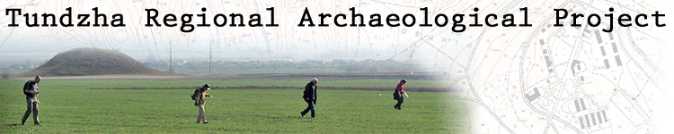
Surface survey and remote sensing. Over the course of 20 days of field walking, three teams averaging five people each covered approximately 27 sq km (17 sq km intensive; 7.9 sq km extensive) of the study area in approximately 20 days of fieldwork, achieving nearly 67.5% coverage of the study area (including about 90% of a contiguous region that had served as our main focus). Most of the target area provided excellent surface visibility thanks to the land cover, which is dominated by fields for annual agriculture that were freshly ploughed and sown with a winter crop.
Palaeoecology. Dr. Connor again joined us, finishing the collection of samples in the Kazanlak region and cored another lake south of Elhovo, in the foothills of the Strandzha mountains. Laboratory work continues, including palynology, palaeomagnetism, and charcoal analysis. We aim to finish an article on the palaeoecology of the Yambol region by January 2010.